

")
")
- GIS solutions
- GIS
Geoinformation systems
GIS
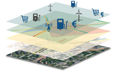
GIS (Geo information systems)
Map and Route develops and operates several GIS components on the basis of HERE, OSM, QGIS etc. We register over 2 billion accesses yearly on maps, routes and geographical data supplied by Map and Route. This is our proof of quality and reliability for our services that we mainly deploy in following areas:
- Directories online/mobile (local pages, white pages, yellow pages, Golocal, GoYellow)
- Transport logistics (preplanning for routes, official licensing processes, truck navigation, ETA calculation and many more)
- Site assessments / Infrastructure planning (e.g. electric loading points for cars)
- Traffic research (mFUND, University cooperations)
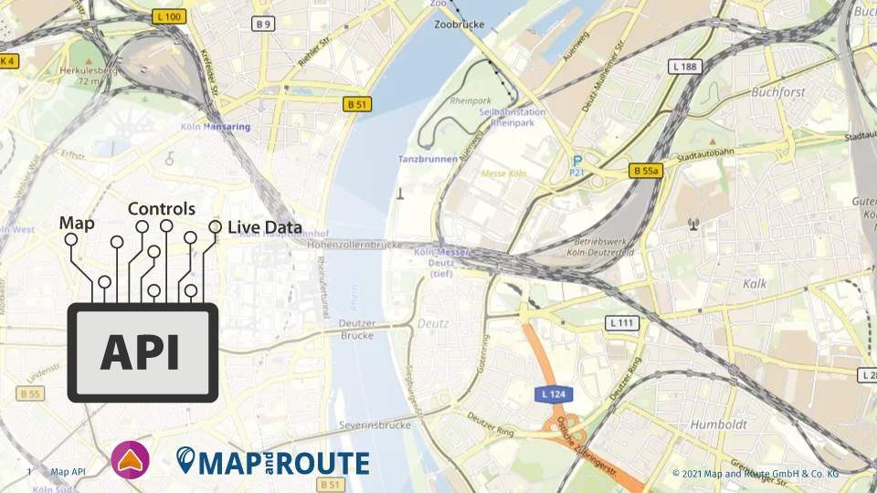
Map-API
The core component for all of our services is the Map-API. It is where we manage, update and count all maps and data layers for our customer services. According to the requirements we deploy maps from HERE or OSM. Then we complete these with any optional data layers and integrate the API in our customer projects.
Please feel free to test our open test data interface and ask us for the possibilities as well as licensing modells.
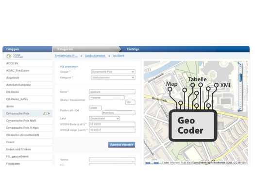
Geocoder
The precision of a geo coordinate is often crucial for the quality and cost efficiency of a service. Deficient geo codes can often lead to detours and subsequently a loss of time as well as increasing costs. Insurance companies need exact GPS coordinates for assessing material damage and for risk calculations. And all of the millions of users would like to find their destinations / objects at the right spot and side of the street.
To best guarantee our geographic codes we integrate all data needed to exactly pinpoint addresses to a geo coordinate. Regular tests of approximately 10 million addresses against API from OSM, Google and HERE for our directory customers prove our high level of commitment and quality.
Together with a geo codification through our Map-API our customers not only receive geo coordinates but also the hit accuracy, the referenced address and with that also a norming of the syntax.
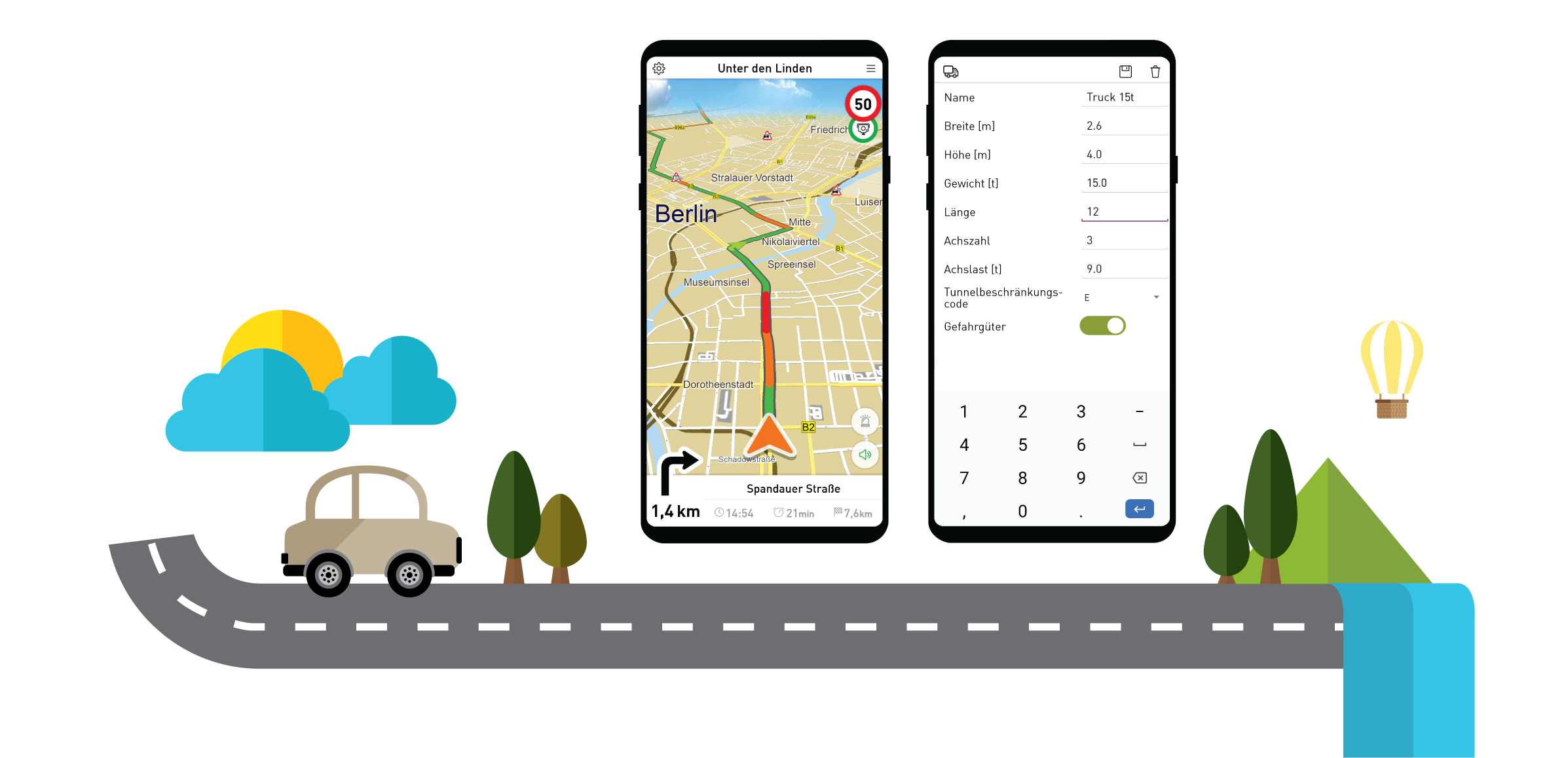
Navigation
In the year 2012, Map and Route built its own navigation solution according to special demands from our directory customers. The V-Navi (Android, iOS) achieved 1.7 million downloads and constantly received good reviews. It was enriched with numerous POI data from Map and Route and also was a favourite in several OEM tenders. Map and Route often reached a good score in many rounds.
The basis of V-Navi is the solution MapTrip® of our partner Infoware which is from now on only available as a customized solution for third-parties. This means that you can supply your customers with a high-end navigation solution within your own brand that you can enrich with your own data, offers and services.
Map and Route uses MapTrip® mainly as a navigation tool for logistic solutions. B2B customers use it to optimise their daily customer routes, to optimise the service sequences at municipal facilities and also to optimise the pick-up and delivery routes. Therefore our customers update their own POI data in the Map and Route MapCMS. These data are then transferred to all MapTrip apps that a customer has licensed for his drivers with Map and Route.
Please feel free to contact us and exchange about the optimal operation of our solutions and geographical data.
Map CMS
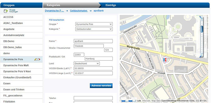
#POI #Geo data #Icons
To meet and manage all possible customer needs and deliver research & development-specific data with aerial relevance, Map and Route has developed its own MapCMS (Content Management System with map integration). According to the needs of our customers, our data editorial staff can edit, service and manage the data. This is also possible for our customers. Upon demand and for billing we can generate reports. This way we are also able to manage and adapt the look and feel of the data (Designs / Icons) as well as the pre-cut and layout of areas (e.g. for logistic delivery or sales purposes).